Paros Map
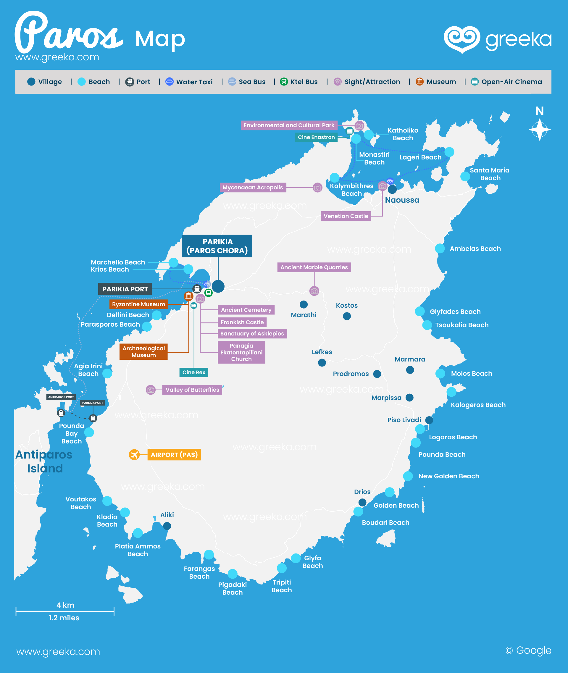
Discover our Map of Paros: Paros is among the most famous islands in the Cyclades for its plethora of interesting sites, beautiful bays, and picturesque villages. The island is a favorite destination of young people for its lively atmosphere and endless parties. Parikia, the island's capital, offers countless options for day and night, from cafes and restaurants to cozy bars and vivid nightclubs that attract eponymous and anonymous people.
• Illustrated map • Interactive map
Map of Naxos
Where is Paros? Paros is the third largest island of the Cyclades and the 20th largest in Greece. Its area reaches 196 sq. km and its coastline is 118 km. It is located in the center of the Aegean Sea, about 90 nautical miles from the port of Piraeus. Paros is blessed with beautiful landscapes and scenery for all tastes. The island is surrounded by traditional villages built by the sea or on mountain slopes. The tourist settlements like Naoussa and Chrissi Akti thrive with activity in the summer period. With its countless whitewashed paths, Cycladic architecture, and gorgeous views, Paros is waiting for you to explore it.
Discover where Paros is on a map of Greece.
Discover the interactive tourist map below. Check the different options and discover where are the best beaches, villages, places to eat, and more.


