Elafonissos is one of the most enchanting islands in Greece located at the southeastern tip of Peloponnese, close to Kythira. It is known for its unspoiled environment that consists of beautiful beaches with crystalline waters. The highest peak of Elafonissos is Vardia, at an altitude of 274 meters.
Elafonissos used to have one of the biggest fishing fleets in Greece and today, most of the inhabitants are involved in fishing. It is extremely quiet in the winter months but during the summer, the island thrives with activity from the tourists and Athenians who come to enjoy the emerald waters of Peloponnese.
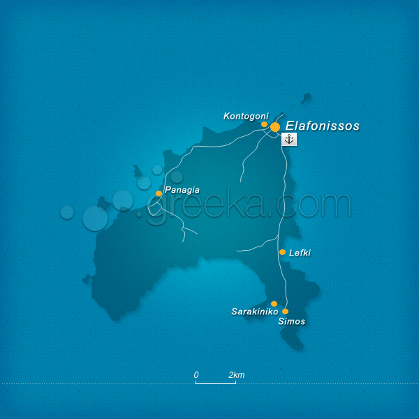
This section proposes a map of Elafonissos with all the major locations.
We use cookies to offer you a better browsing experience and to analyze site traffic. By browsing this site you agree to our use of cookies. Learn more about our cookies policy


