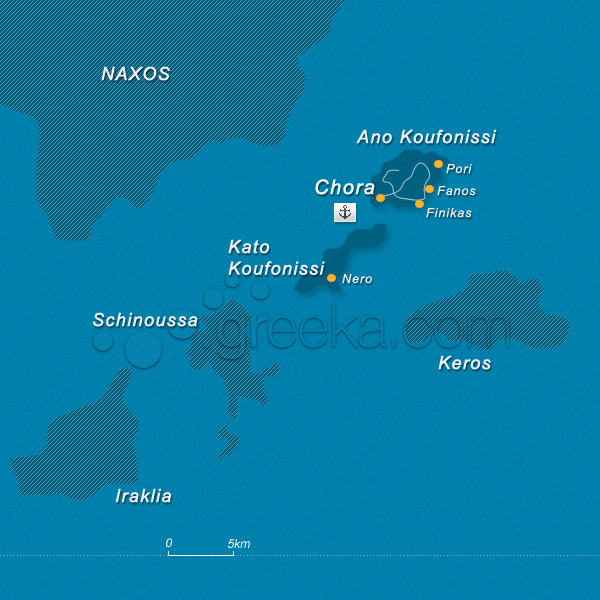
Koufonisia can be described as one of the most magnificent islands in the Cyclades lying between Naxos and Amorgos. It comprises three tiny islands, Pano and Kato Koufonisi and Keros islet characterized by the exotic beaches and virgin landscape.
Pano Koufonissi is the smallest yet the most densely populated island of the two with some churches and idyllic beaches with crystalline waters. On the other hand, Kato Koufonisi is quite surprising featuring an unspoiled character but still with a number of secluded coves which provide some ideal relaxation to every visitor. It used to be uninhabited but some of the locals moved from Pano Koufonisi.
Koufonisia is known as the fishermen island as locals are greatly involved in fishing for many decades to this day. The beautiful islet located right opposite Koufonisia has deep roots n the ancient years as it has been declared a protected an archaeological site after the discovery of important artifacts of Cycladic Art. Today, it is uninhabited.
This section proposes a map of Koufonisia with all the major locations of the island.
We use cookies to offer you a better browsing experience and to analyze site traffic. By browsing this site you agree to our use of cookies. Learn more about our cookies policy


