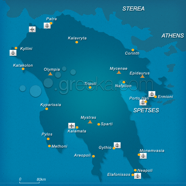
Discover our Map of Peloponnese, in Greece but also maps of many locations of the region: Peloponnese is the most famous region of the Greek mainland. Located on the southern side of the country, as you can see on our map of Peloponnese, its shape looks like a plane tree leaf. It is bordered with water from all sides and it is connected to the rest of the mainland in two points: the Corinth Canal and the cable bridge of Rio-Antirrio. Although the center of Peloponnese is mountainous, many summer resorts have developed around the coastline.
Rich in natural beauty, fabulous beaches, and archaeological sites, Peloponnese is a great place for family vacations, romantic breaks or even a day trip from Athens. Famous places in Peloponnese include Nafplion, Monemvasia, Olympia, Gythio, Kalamata, and Elafonissos.
This section proposes a Peloponnese map with all the major locations of the region. You can also get informed about the Geography.
We use cookies to offer you a better browsing experience and to analyze site traffic. By browsing this site you agree to our use of cookies. Learn more about our cookies policy


