Map of Ancient Greece
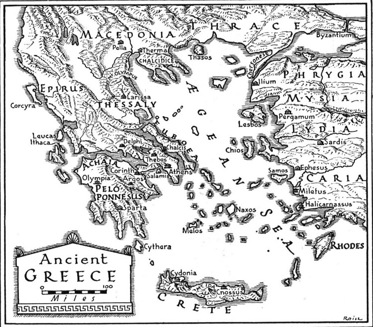
Here is an Ancient Greece map, featuring how the country was like in the ancient times, during the peak centuries of its history. In this map of Ancient Greece, you can spot the various regions of the mainland, the islands in the Aegean and the Ionian Sea as well as the Greek colonies in Asia Minor, a region that was first settled by Greek towns in the 8th century AD and were continuously inhabited by Greeks until the early 20th century, right after the First World War.
See the geographical location of Athens and Sparta, the most important ancient Greek cities in the classical times, as well as Corinth, Pella and Thebes, three cities that played a significant role through the historical course of Greece. You can also spot the location of ancient sanctuaries, such as Olympia and Delphi, that are included today among the most important archaeological sites to visit in the Greek mainland.
For a better understanding of this Ancient Greece map, read the history of Ancient Greece. In order to make some comparisons with the present geographical state of the country, you can view the modern map of Greece.


