Mykonos Map
Discover our Map of Mykonos ! You will find below several maps:
• Illustrated map • Interactive map
Mykonos is one of the most famous destinations in Greece for its party atmosphere and charming beaches. The island is characterized by its picturesque town, idyllic quarters, and beautiful coves. Besides its natural beauty, Mykonos is mostly known for its exciting nightlife in the capital and surrounding beaches, where parties last for days. The atmosphere is unique for all ages and tastes.
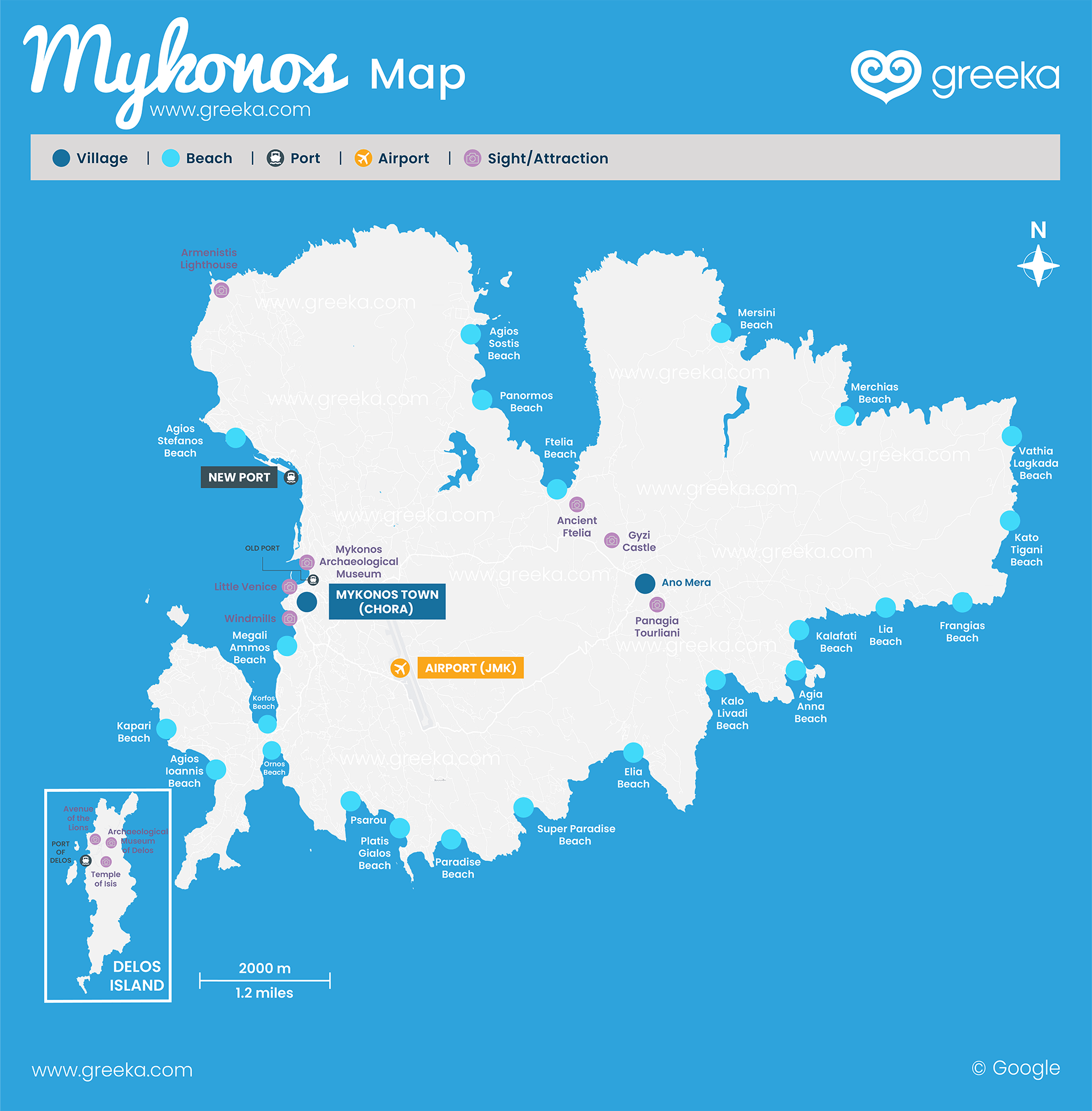
Map of Mykonos
Where is Mykonos? Mykonos is a Greek island located in the northern part of the Cycladic island group in the Aegean Sea. Despite its small size, it is one of the best-developed islands in Greece in terms of tourism infrastructure and one of the most famous ones, especially for travelers looking for a place with a vibrant nightlife. The enchanting Cycladic island lies approximately 150 km from Athens, the capital city of Greece, and the connection between these two is achieved by ferries and flights. Mykonos has a very convenient location for those interested in island hopping since other Cycladic islands, including Tinos, Andros, Paros, Syros, and Naxos, are located very close to it.
Discover where Mykonos is on a map of Greece.
Discover the interactive tourist map below. Check the different options and discover where are the best beaches, villages, places to eat, and more.


