Thessaloniki is the second largest city of Greece, after Athens, the Greek capital, located in Northern Greece, central Macedonia. The town is characterized for its major historical interest and natural beauty as it counts on many archaeological monuments and historical relics, idyllic coasts, and mountainous landscapes.
Being a cosmopolitan town itself, Thessaloniki is a major tourist destination all year round offering access to some of the most famous resorts in Greece like Thessaloniki and Thassos which are preferred by thousands of tourists around the world. Moreover, its strategic location provides a nice port that serves vessels from the Black Sea and northern Aegean.
The modern city of Thessaloniki is known as a cultural center hosting various festivals and world-famous events throughout the year. However, it is also a place that well-maintains its traditional customs and authentic character. Wondering around the historical town you will see countless picturesque spots and monuments that witness its glorious past.
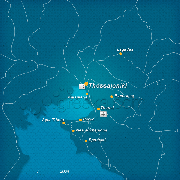
This section proposes a map of Thessaloniki with all the major locations.
We use cookies to offer you a better browsing experience and to analyze site traffic. By browsing this site you agree to our use of cookies. Learn more about our cookies policy


