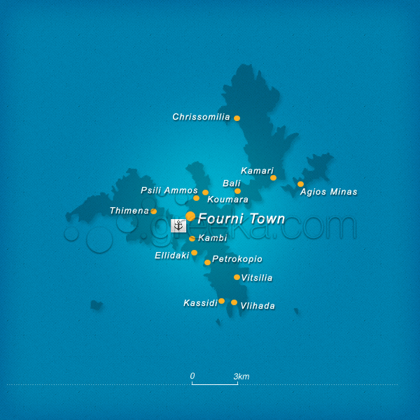
Fourni is an island complex which lies between Samos and Ikaria, on the Eastern Aegean Sea. It consists of three large islands and nine rocky islets. The island group was named after the larger island of Fournoi followed by Thymena and Agios Minas. Fourni is one of the most famous fishing destinations in Greece and a peaceful island for vacation.
The main settlement of Fournoi is well-maintained traditional with a few taverns and quiet cafes looking at the sea. Equally beautiful and attractive are the other settlements of the island-like Chrisomilia and Kambi. Most beaches are remote and the island is blessed with some fabulous landscapes and trekking paths. All distances can be covered on foot.
This section proposes a map of Fourni with all the major locations of the island.
We use cookies to offer you a better browsing experience and to analyze site traffic. By browsing this site you agree to our use of cookies. Learn more about our cookies policy


