Rhodes is the largest island of the Dodecanese and a place where many civilizations found shelter throughout the centuries. The verdant island with the idyllic endless beaches, the cosmopolitan resorts, ancient sites, and peaceful spots attracts thousands of tourists from every part of the world. Its medieval capital is a beautiful sightseeing itself and one of the best-preserved cities in Europe counting on many impressive castles, Byzantine churches, and Venetian fortresses, the Palace of Grand Master being the most important.
Inside the medieval castle walls, tourists can follow the traces of Rhodes culture and see the plethora of interesting sites. Once you are out of the castle, you can take a walk at the modern city which is equally beautiful and attractive. The surrounding settlements of Rhodes will give you a more traditional aspect of the island, with picturesque neighborhoods and old churches. Rhodes is an ideal destination for your summer vacations.
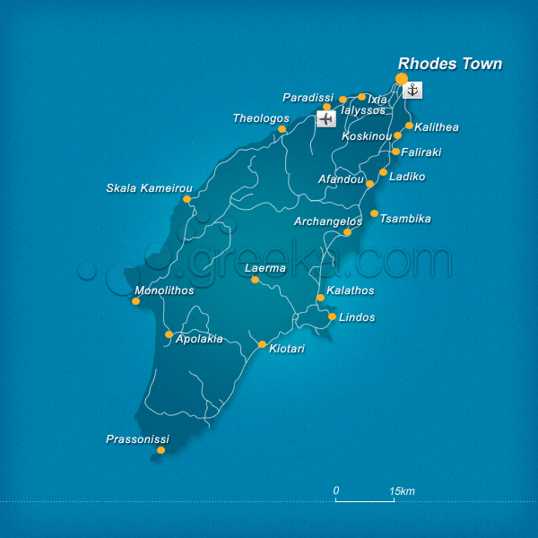
This section proposes a map of Rhodes with all the major locations of the island.
We use cookies to offer you a better browsing experience and to analyze site traffic. By browsing this site you agree to our use of cookies. Learn more about our cookies policy


