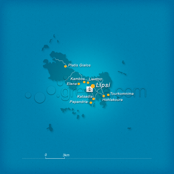
Lipsi is an unspoiled island of the Dodecanese, located between Patmos and Lipsi. Lipsi is a cluster of islands and it was named after the largest island, the only one inhabited to this day. The island is surrounded by many rocky islets like Aspronisia, Kalapodia, Frango, and Plavi. Lipsi is a tiny island and very easy to explore on foot. Besides its serene atmosphere, its stands out for its sandy beaches.
Chora lies above the main port with the typical whitewashed houses, taverns, and restaurants. It is the center of all activities. The island itself and the surrounding islets of Lipsi are a great pole of attraction for the tourists who arrive with boats. The very few inhabitants are involved in fishing.
This section proposes a map of Lipsi with all the major locations of the island.
We use cookies to offer you a better browsing experience and to analyze site traffic. By browsing this site you agree to our use of cookies. Learn more about our cookies policy


