Santorini Map
Discover our Map of Santorini! You will find several maps below:
• Illustrated map • Other maps • Interactive map
Santorini is one of the most popular summer destinations in Greece and is part of the famous Cyclades complex. The island's incomparable, globally unique beauty attracts thousands of visitors all year round. The island was formed after a volcanic eruption and consists of several islets. It is blessed with a spectacular landscape like the impressive caldera, traditional settlements like Fira and Oia lying on top of the impressive cliffs, and ancient sites.
Map of Santorini
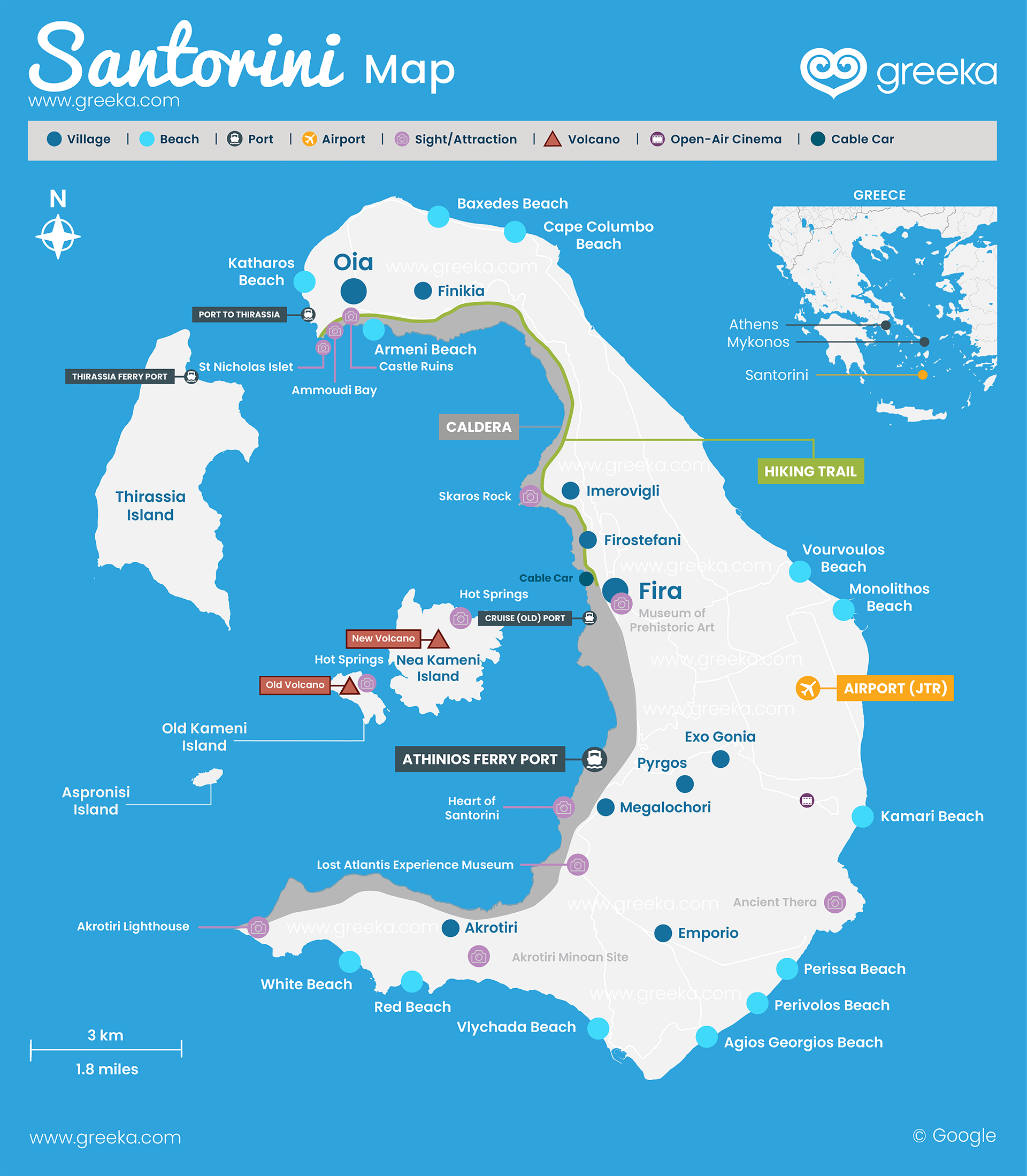
Map Of Santorini
Where is Santorini?
Santorini (or Thera) is an island in the southern Aegean Sea. It belongs to the renowned group of islands called the Cyclades. Other famous islands belonging to the complex are Mykonos, Paros, and Naxos. It is located 200 km from Athens and is accessible by plane and ferry. It also lies 150 km from Mykonos and 140 km from Crete, between the islands of Ios and Anafi. It covers an area of 90 km2 and is actually an archipelago of islands created by several volcanic eruptions. The islands of that small archipelago are Thirasia, Aspronisi, and the volcanic islands of Palea Kameni and Nea Kameni. Before being separated from each other, those islands formed a single island, which was called Strongili.
Discover where Santorini is on a map of Greece.
An island for the romantic souls, Santorini leaves all visitors spellbound with its rare and wild beauty and astonishing views. The island is ideal for all vacationers as it boasts world-famous facilities and traditional apartments for all tastes. Your walks in the cobbled streets of the settlements perched high above the sea will remain unforgettable.
Other maps available:
- Bus map
- Wineries map
- Hotels map
Discover the interactive map of Santorini below. Check the different options and discover where are the best beaches, villages, places to eat, and more.


