Naxos Map
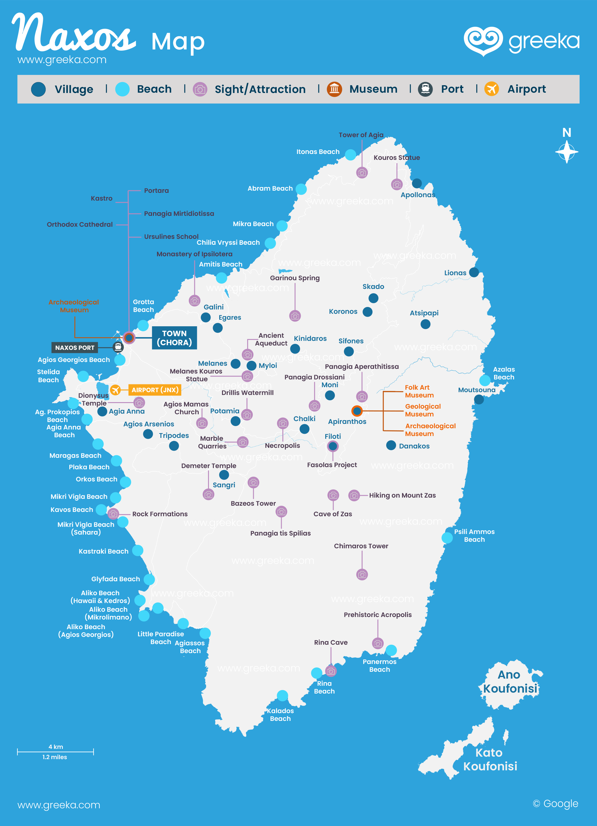
Discover our Map of Naxos! Naxos island is blessed with beautiful bays, isolated coves, green valleys, and mountainous landscapes, offering visitors a chance to explore the diverse settlements and sceneries. Naxos will embrace you with its warm Venetian atmosphere and cozy hospitality. There are countless options, whether you stay in Chora or at the smaller settlements.
• Illustrated map • Interactive map
Map of Naxos
Where is Naxos? Naxos is the largest island of the Cyclades islands group, covering an area of 429 km2. Boasting historical and cultural sites, marvelous beaches, a multifaceted landscape, and fresh products, it is the island that can meet every traveler's needs. It is located in the heart of the Cyclades, approximately 181 km (98 nautical miles) away from Piraeus, the main port of Athens, between Mykonos, Paros, Koufonisia, and Donoussa. The island is reachable by both ferry and plane and comprises an excellent island-hopping destination due to its proximity to other islands and the frequent ferry crossings during the high season.
Discover where Naxos is on a map of Greece.
Discover the interactive tourist map below. Check the different options and discover where are the best beaches, villages, places to eat, and more.


